 |
South Carolina Backcountry Revolutionary War SitesWebsite Created By Phil Norfleet |
 |
|
|
South Carolina Backcountry Revolutionary War SitesWebsite Created By Phil Norfleet |
|
![]()
![]()
![]()
![]()
![]()
![]()
Grindal Shoals
The following is an extract from a pamphlet located in the Union County SC Public Library entitled History of Jonesville (undated) by Jesse Calvert III, page 2:
A few miles northeast of Jonesville on Pacolet River was the location of the old Grindal Shoals, the most noted ford on the Pacolet during the Revolution. It is said that John Grindal came to the beautiful shoal on the Pacolet and obtained a grant for it and adjacent lands; and hence the name Grindal Shoal. It is said that he was the first white settler to own land in Grindal Shoals. It was just below this point of an island in the river that the noted ford of Revolutionary times was located, which J. P. Kennedy in his book, Horse Shoe Robinson, called Grindal's Ford. This shoal is known to all that are familiar with South Carolina history as a strategic point and crossing place. There was none in the country of greater importance, since it was one of the most noted and historic places in Upper South Carolina during the Revolution and many years afterward. None of the battles of the Revolution were fought at Grindal Shoals, but many historic incidents occurred there that were important. It was there that General Morgan encamped for twenty days before the Battle of The Cowpens. It was while General Morgan was stationed at Grindal Shoals that Colonel Washington discovered a spy in the camp and took him out and hung him to a tree. During the time of his encampment, Morgan did not stay at Grindal all the time, but for strategic reasons he alternated frequently between that point and Burr's mill on Thickety. The location of the camp at Grindal was on the east side of the river, on the ridge rising just opposite in the river and extended up as far as the Littlejohn place. Near the lower end of this ridge stood an old ante-bellum mansion, known then as the "Aunt Sally Norris house." This house marked the exact spot where General Morgan's tent stood. After seven long years of untold sacrifice and suffering endured by the sturdy Whig pioneers, their much coveted prize of liberty was won. The British armies were driven from the country, and the American colonies were free and independent. Unwelcome sounds, such as the tread of armies, the report of guns, the crackling of flames and the wails of distress, gave way to the gentle cooing of the dove of peace, which now stretched its wings over what was destined to be the greatest commonwealth that the sun ever shown upon. With battle scars, battered swords and tattered garments, these conquering heroes returned to their cabins and hung their trusted rifles, shot-bags and powder-horns on the racks above the door; and for the first time, around their cheerful log-fires, breathed the air of freedom and smoked the pipe of peace. With the same indomitable energy and determination shown in war, they set about to build up the waste places, restore their shattered fortunes and to lay the foundations upon which our modern super-structures are built. Such conditions would naturally create the necessity for small public enterprises, such as mills, stores, etc., and for the people about Grindal, the Shoals would be the logical place.
In August, 1852 there was the great Pacolet River flood, which practically destroyed all the mills and stores.
According to the author of Horse Shoe Robinson, there was a tavern a short distance from Grindal Ford known as "Christies Tavern," where liquor was sold and travelers could get lodging. After all these years this tavern is still standing. It was at this tavern that Captain Butler and Sergeant Horseshoe Robinson were taken as prisoners by Captain Habershaw, and while the Tories were eating breakfast that Horseshoe made his escape.
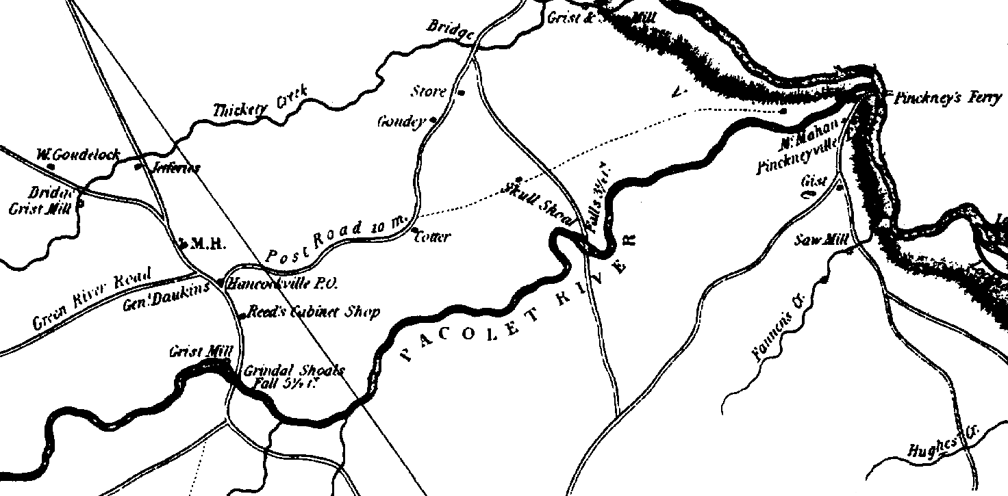
Map of Grindal Shoals Area
This map, derived from the Union County map contained in the 1825 Mills Atlas of South Carolina, focuses on that part of what was then northern Union County (now Cherokee County) that was bordered by Thicketty Creek in the north, Pacolet River in the south, and Broad River to the west. The well known Whig supporter, John Nuckolls, is buried on Whig Hill, near Grindal Shoals.
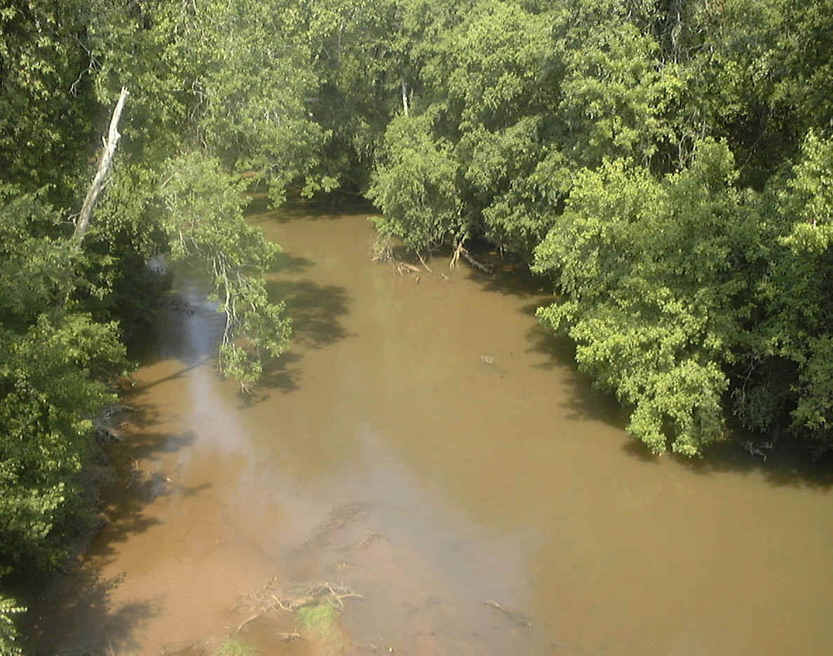
Photographs of Grindal Shoals Area
In the 18th Century, Grindal Shoals on Pacolet River was a thriving community with grist mills situated on both sides of the river. It was located where SC18 now crosses the Pacolet, right on the border between the modern-day counties of Union and Cherokee. Prior to the formation of Cherokee County in 1897, all of this area was part of Union County.
The noted Whig, John Nuckolls, lived in this area, on nearby Whig Hill. Nuckolls was murdered by Tories on the night of 11 December 1780 and is buried on Whig Hill.
In January 1781, the army of Brigadier General Daniel Morgan camped here. When Lt. Colonel Banastre Tarleton began his pursuit of Morgan, that ended with the Battle of Cowpens, he rested his forces at Morgan's abandoned campsite.
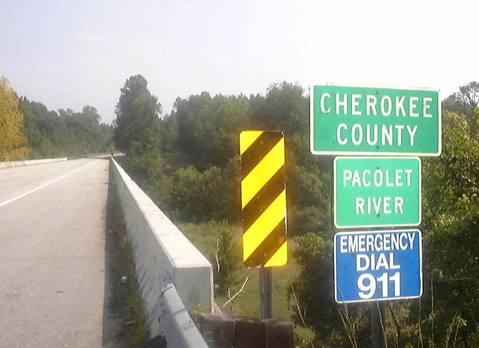
The Bridge over Pacolet River at Grindal Shoals - on the Boundary between Union and Cherokee Counties, South Carolina
Downstream view of Pacolet River at Grindal Shoals. The modern Pacolet River has very little water flowing in it; however, this was not the case in the 18th Century.